
1971 Map of Clarkville NE
USGS Topo · Published 1974About this map
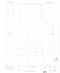
Patent Creek winds through the high plains of eastern Colorado, marking the subtle drainage of this agricultural landscape in the early 1970s. Located along the boundary of Phillips Co and Yuma Co, the area is defined by its wide-open survey sections and practical land use. A rural gathering point is found at Ford Ch, which serves as a landmark amidst the gridded section roads and scattered wells. Industrial and transport footprints are visible through a Pipeline crossing the northern portion of the quadrangle, a remote Landing Strip, and a localized Gravel Pit. Benchmarks like BM 3968 and BM 3922 provide precise elevation data for this high-altitude terrain, where fine red dashed lines on the map indicate selected fence lines that define property and grazing boundaries.
Find a feature on this map
10 named features on this map. Tap any name to fly to it.
Don’t see what you’re looking for? This feature index may not catch every label — zoom into the map to look around manually.
Map Details
Editions of this 1971 Clarkville NE Map
2 editions found
Other maps of this area

1954 · Sterling
USGS Topo · 1:250,000

1958 · Sterling
USGS Topo · 1:250,000

1971 · Paoli
USGS Topo · 1:24,000

1971 · Fiddler Peak
USGS Topo · 1:24,000

1971 · Haxtun SE
USGS Topo · 1:24,000

1971 · Clarkville SE
USGS Topo · 1:24,000

1971 · Old Baldy
USGS Topo · 1:24,000

1972 · Clarkville
USGS Topo · 1:24,000

1972 · Rockland
USGS Topo · 1:24,000

1972 · Clarkville SW
USGS Topo · 1:24,000