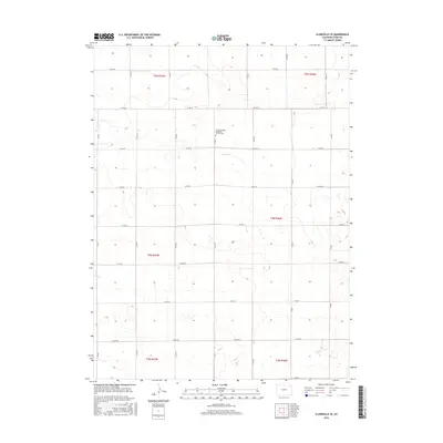
2016 Map of Clarkville SE
USGS Topo · Published 2016About this map
Pleasant Valley Methodist Church Cem serves as a central landmark for this rural portion of Yuma County, marking a localized pocket of community history within the High Plains. The landscape is defined by the ephemeral drainage of Rock Cr, which cuts through the township lines of t4n r47w and t5n r46w. The topography reveals a strictly organized section-line grid, where essential transit is facilitated by routes such as Co Rd 55 and Co Rd 51. This 2016 survey illustrates the endurance of traditional land divisions and small-scale religious sites in an area dominated by agriculture and open range. The sparse distribution of named features highlights the significance of each individual site, particularly where cemetery records may provide vital clues for regional genealogy.
Find a feature on this map
25 named features on this map. Tap any name to fly to it.
Don’t see what you’re looking for? This feature index may not catch every label — zoom into the map to look around manually.
Map Details
Editions of this 2016 Clarkville SE Map
This is the sole edition of this map. No revisions or reprints were ever made.
Other maps of this area

1954 · Sterling
USGS Topo · 1:250,000

1958 · Sterling
USGS Topo · 1:250,000

1971 · Fiddler Peak
USGS Topo · 1:24,000

1971 · Clarkville NE
USGS Topo · 1:24,000

1971 · Yuma NE
USGS Topo · 1:24,000

1971 · Clarkville SE
USGS Topo · 1:24,000

1971 · Old Baldy
USGS Topo · 1:24,000
1971 · Eckley NW
USGS Topo · 1:24,000

1972 · Clarkville
USGS Topo · 1:24,000

1972 · Clarkville SW
USGS Topo · 1:24,000