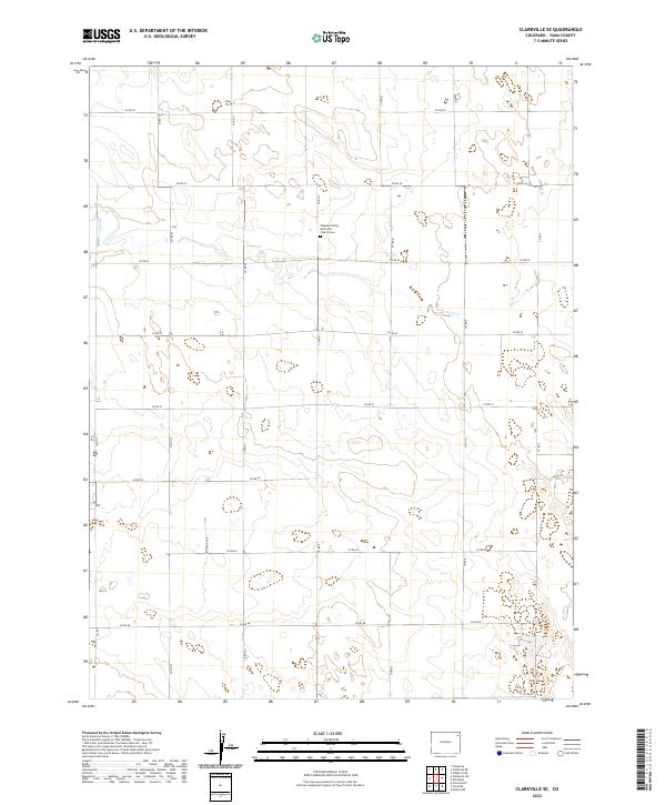
2022 Map of Clarkville SE
USGS Topo · Published 2022About this map
The high plains of eastern Colorado define this corner of Yuma County, where a grid of rural roads like Co RD 55 and Co RD 54 carves through the landscape. The most prominent community landmark on the map is the Pleasant Valley Methodist Church Cem, situated near the intersection of Co RD 53 and Co RD P. This site provides a vital point of reference for genealogists tracking early settlers in the vicinity. The terrain is marked by intermittent watercourses, most notably Rock Cr, which winds through the northwestern sections of the quadrangle. The map layout reflects the Public Land Survey System, with township and range lines such as t4n r47w and t5n r46w illustrating the organized division of the prairie for agricultural use.
Find a feature on this map
18 named features on this map. Tap any name to fly to it.
Don’t see what you’re looking for? This feature index may not catch every label — zoom into the map to look around manually.
Map Details
Editions of this 2022 Clarkville SE Map
This is the sole edition of this map. No revisions or reprints were ever made.
Other maps of this area

1954 · Sterling
USGS Topo · 1:250,000

1958 · Sterling
USGS Topo · 1:250,000

1971 · Fiddler Peak
USGS Topo · 1:24,000

1971 · Clarkville NE
USGS Topo · 1:24,000

1971 · Yuma NE
USGS Topo · 1:24,000

1971 · Clarkville SE
USGS Topo · 1:24,000

1971 · Old Baldy
USGS Topo · 1:24,000
1971 · Eckley NW
USGS Topo · 1:24,000

1972 · Clarkville
USGS Topo · 1:24,000

1972 · Clarkville SW
USGS Topo · 1:24,000