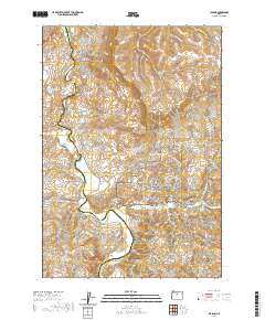
2020 Map of Clarno
USGS Topo · Published 2020About this map
The John Day Wild and Scenic River carves a path through this high-desert landscape on the border of Wasco and Wheeler Counties. This central Oregon terrain is defined by its remarkable geologic history, most notably within the John Day Fossil Beds National Monument. Here, visitors and researchers find significant paleontological sites near Clarno, including The Palisades and the Clarno Arch. The map detail reveals several interpretive trails such as the Geo Loop, Arch Trail, and Indian Canyon Loop that navigate the unique rock formations of the Red Hill and Hancock Canyon areas.
Find a feature on this map
45 named features on this map. Tap any name to fly to it.
Don’t see what you’re looking for? This feature index may not catch every label — zoom into the map to look around manually.
Map Details
Editions of this 2020 Clarno Map
This is the sole edition of this map. No revisions or reprints were ever made.
Other maps of this area

1916 · Condon
USGS Topo · 1:125,000

1926 · Mitchell
USGS Topo · 1:125,000

1953 · The Dalles
USGS Topo · 1:250,000

1955 · Bend
USGS Topo · 1:250,000

1956 · The Dalles
USGS Topo · 1:250,000

1957 · Bend
USGS Topo · 1:250,000

1957 · The Dalles
USGS Topo · 1:250,000

1958 · Bend
USGS Topo · 1:250,000

1966 · Antelope
USGS Topo · 1:62,500

1966 · Clarno
USGS Topo · 1:62,500