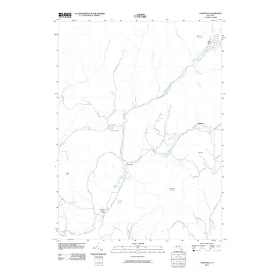
2010 Map of Claryville
USGS Topo · Published 2010About this map
The confluence of the West Branch Neversink River and East Branch Neversink River at Claryville defines this mountain landscape in the southern Catskills. This 2010 survey illustrates a region characterized by remote settlements and outdoor institutions, such as Camp Wawayanda in the northeast and Camp Pine near the river fork. A significant piece of local heritage, the Halls Mills Covered Bridge, is located further south along the main stem of the Neversink River. The rugged topography is shaped by prominent heights like Denman Mountain and Blue Hill, with steep valleys carrying numerous tributaries including Fall Brook, Willowemoc Creek, and Shelter Creek. Local travel follows winding mountain corridors such as Frost Valley Rd and Denning Rd, connecting small communities like Frost Valley and Ladleton through the timbered terrain.
Find a feature on this map
47 named features on this map. Tap any name to fly to it.
Don’t see what you’re looking for? This feature index may not catch every label — zoom into the map to look around manually.
Map Details
Editions of this 2010 Claryville Map
This is the sole edition of this map. No revisions or reprints were ever made.
Other maps of this area

1900 · Phoenicia
USGS Topo · 1:62,500

1901 · Margaretville
USGS Topo · 1:62,500

1903 · Phoenicia
USGS Topo · 1:62,500

1903 · Slide Mountain
USGS Topo · 1:62,500

1904 · Margaretville
USGS Topo · 1:62,500

1905 · Slide Mountain
USGS Topo · 1:62,500

1910 · Neversink
USGS Topo · 1:62,500

1942 · Neversink
USGS Topo · 1:62,500

1942 · Lackawack
USGS Topo · 1:24,000

1943 · Peekamoose Mountain
USGS Topo · 1:31,680