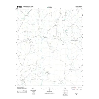
2011 Map of Claud
USGS Topo · Published 2011About this map
Claud and the surrounding rural landscape of Elmore County are defined by a network of creeks and small residential clusters. During the early 21st century, the area shows a distinct pattern of family and community heritage, marked by numerous burial grounds like Sheppard Cemetery, Wall Cemetery, and Green Cemetery. The terrain is characterized by the divide between several water systems, including Chubbehatchee Creek, Townsend Creek, and Tumkeehatchee Creek, which flow southward toward the Tallapoosa River basin.
Find a feature on this map
88 named features on this map. Tap any name to fly to it.
Don’t see what you’re looking for? This feature index may not catch every label — zoom into the map to look around manually.
Map Details
Editions of this 2011 Claud Map
This is the sole edition of this map. No revisions or reprints were ever made.
Other maps of this area

1901 · Wetumpka
USGS Topo · 1:125,000

1901 · Wetumpka
USGS Topo · 1:62,500

1903 · Wetumpka
USGS Topo · 1:125,000

1906 · Dadeville
USGS Topo · 1:125,000

1953 · Montgomery
USGS Topo · 1:250,000

1955 · Phenix City
USGS Topo · 1:250,000

1956 · Montgomery
USGS Topo · 1:250,000

1957 · Phenix City
USGS Topo · 1:250,000

1957 · Montgomery
USGS Topo · 1:250,000

1958 · Phenix City
USGS Topo · 1:250,000