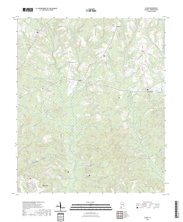
2024 Map of Claud
USGS Topo · Published 2024About this map
Eclectic and Redland anchor the northern and southern reaches of this Elmore County landscape, where the terrain is defined by the winding paths of Chubbehatchee Creek and Tumkehatchee Creek. The settlement pattern follows a network of rural roads like Claud Rd and Fleahop Rd, connecting small communities such as Claud and Good Hope. This modern survey reveals a region deeply rooted in its local heritage, evidenced by the numerous family and community burial grounds including Sheppard Cem, Wall Cem, and China Grove Cem. The geography transitions from the elevations of Heck Ridge into the low-lying Crabapple Valley, illustrating how the natural drainage of branches like Abercomby Branch has historically dictated the placement of homesteads and connector routes in this part of Alabama.
Find a feature on this map
90 named features on this map. Tap any name to fly to it.
Don’t see what you’re looking for? This feature index may not catch every label — zoom into the map to look around manually.
Map Details
Editions of this 2024 Claud Map
This is the sole edition of this map. No revisions or reprints were ever made.
Other maps of this area

1901 · Wetumpka
USGS Topo · 1:125,000

1901 · Wetumpka
USGS Topo · 1:62,500

1903 · Wetumpka
USGS Topo · 1:125,000

1906 · Dadeville
USGS Topo · 1:125,000

1953 · Montgomery
USGS Topo · 1:250,000

1955 · Phenix City
USGS Topo · 1:250,000

1956 · Montgomery
USGS Topo · 1:250,000

1957 · Phenix City
USGS Topo · 1:250,000

1957 · Montgomery
USGS Topo · 1:250,000

1958 · Phenix City
USGS Topo · 1:250,000