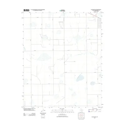
2012 Map of Claude SW
USGS Topo · Published 2012About this map
Finley Ranch Airport stands as a primary aviation landmark in this portion of the Texas Panhandle, situated within a landscape defined by an orderly grid of rural transport and ephemeral water features. The drainage of Mulberry Cr meanders through the central terrain, providing the primary hydrological relief against the flat agricultural expanse. The road network utilizes a distinctive phonetic naming convention for east-west routes, including India, Juliet Rd, Kilo Rd, Lima, and Mike, suggesting a highly organized system of land management and property access. These routes, alongside major corridors like FM-1151 and Ranch Road 3330, connect the isolated ranching and farming operations that characterize this region southwest of Claude.
Find a feature on this map
20 named features on this map. Tap any name to fly to it.
Don’t see what you’re looking for? This feature index may not catch every label — zoom into the map to look around manually.
Map Details
Editions of this 2012 Claude SW Map
This is the sole edition of this map. No revisions or reprints were ever made.
Other maps of this area

1954 · Amarillo
USGS Topo · 1:250,000

1954 · Plainview
USGS Topo · 1:250,000

1956 · Washburn
USGS Topo · 1:24,000

1958 · Amarillo
USGS Topo · 1:250,000

1958 · Plainview
USGS Topo · 1:250,000

1960 · Fairview
USGS Topo · 1:24,000

1960 · Claude
USGS Topo · 1:62,500

1960 · Wayside
USGS Topo · 1:62,500

1963 · Luttrell Springs
USGS Topo · 1:24,000

1963 · Luttrell Springs NE
USGS Topo · 1:24,000