
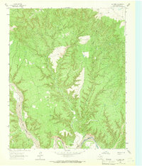
1963 Map of Luttrell Springs
USGS Topo · Published 1966About this map
The Little Red River and its various tributaries carve a complex drainage pattern through this portion of Armstrong County. Steep elevation changes are most pronounced around Horseshoe Canyon and the surrounding breaks, where the Salt Fork and Dry Creek converge. Small clusters of human activity are marked by the names Brunson, Doyle, and Ransom, though the landscape remains primarily defined by its hydrology and natural springs.
Find a feature on this map
12 named features on this map. Tap any name to fly to it.
Don’t see what you’re looking for? This feature index may not catch every label — zoom into the map to look around manually.
Map Details
Editions of this 1963 Luttrell Springs Map
This is the sole edition of this map. No revisions or reprints were ever made.
Other maps of this area

1954 · Amarillo
USGS Topo · 1:250,000

1954 · Plainview
USGS Topo · 1:250,000

1958 · Amarillo
USGS Topo · 1:250,000

1958 · Plainview
USGS Topo · 1:250,000

1960 · Fairview
USGS Topo · 1:24,000

1960 · Claude
USGS Topo · 1:62,500

1960 · Wayside
USGS Topo · 1:62,500

1963 · Luttrell Springs NE
USGS Topo · 1:24,000

1963 · Pleasant Creek
USGS Topo · 1:24,000
1963 · Gip Creek
USGS Topo · 1:24,000