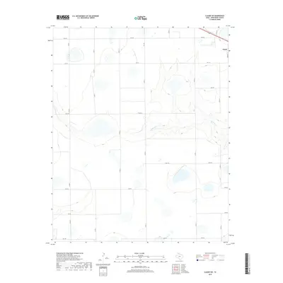
2019 Map of Claude SW
USGS Topo · Published 2019About this map
Claude anchors the northeastern corner of this Panhandle landscape, where the flat upland plains begin to break into the drainage systems of the Red River basin. The most significant topographic shift occurs along Mulberry Cr, which carves a winding path across the central-eastern portion of the quadrangle. This area is defined by a rigid grid of rural corridors, including Fm 1151 and Fm 1258, which intersect a series of secondary roads with distinct phonetic names like Juliet Rd, Kilo Rd, and Lima Rd. The transition from the high, level fields near Echo Rd to the more varied relief surrounding the creek bed illustrates the classic erosion patterns of the Texas high plains, providing a clear view of how local transport and land use navigate the shifting elevation.
Find a feature on this map
18 named features on this map. Tap any name to fly to it.
Don’t see what you’re looking for? This feature index may not catch every label — zoom into the map to look around manually.
Map Details
Editions of this 2019 Claude SW Map
This is the sole edition of this map. No revisions or reprints were ever made.
Other maps of this area

1954 · Amarillo
USGS Topo · 1:250,000

1954 · Plainview
USGS Topo · 1:250,000

1956 · Washburn
USGS Topo · 1:24,000

1958 · Amarillo
USGS Topo · 1:250,000

1958 · Plainview
USGS Topo · 1:250,000

1960 · Fairview
USGS Topo · 1:24,000

1960 · Claude
USGS Topo · 1:62,500

1960 · Wayside
USGS Topo · 1:62,500

1963 · Luttrell Springs
USGS Topo · 1:24,000

1963 · Luttrell Springs NE
USGS Topo · 1:24,000