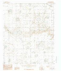
1983 Map of Claude SW
USGS Topo · Published 1984About this map
Badgley Lake and the drainage of Mulberry Creek define this section of Armstrong County, captured during a 1980 field check for this provisional survey. The landscape is characterized by the intricate contouring of the Texas Panhandle, showing the intermittent water systems and depressions that mark the high plains. While the map is sparse in terms of dense settlement, it provides precise topographical data for the rural stretches southwest of the county seat. Geologists and land researchers can trace the natural landforms and elevation changes at a five-foot contour interval, a level of detail that reveals the subtle shifts in the plains before they reach the more dramatic breaks of the nearby canyons.
Find a feature on this map
3 named features on this map. Tap any name to fly to it.
Don’t see what you’re looking for? This feature index may not catch every label — zoom into the map to look around manually.
Map Details
Editions of this 1983 Claude SW Map
This is the sole edition of this map. No revisions or reprints were ever made.
Other maps of this area

1954 · Amarillo
USGS Topo · 1:250,000

1954 · Plainview
USGS Topo · 1:250,000

1956 · Washburn
USGS Topo · 1:24,000

1958 · Amarillo
USGS Topo · 1:250,000

1958 · Plainview
USGS Topo · 1:250,000

1960 · Fairview
USGS Topo · 1:24,000

1960 · Claude
USGS Topo · 1:62,500

1960 · Wayside
USGS Topo · 1:62,500

1963 · Luttrell Springs
USGS Topo · 1:24,000

1963 · Luttrell Springs NE
USGS Topo · 1:24,000