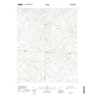
2019 Map of Claudville
USGS Topo · Published 2019About this map
Claudville sits at the heart of this landscape where the Piedmont meets the southern Appalachian foothills, a region defined by the winding course of the Dan River and its numerous tributaries. Small rural communities like Asbury, Carters Mill, and Woodville are connected by a dense network of secondary roads, including Ararat Hwy and Kibler Valley Rd, which navigate the prominent ridges of Mill Mtn and Simmons Mtn. The map reveals a high concentration of ancestral burial sites, such as Unity Cem and Mount Herman Cem, which serve as vital markers for local genealogists tracing family roots in this cross-border region. The landscape is also characterized by significant water features, from the Little Dan River to the man-made Big Dan Lake, highlighting the enduring importance of the river systems to the local economy and settlement patterns.
Find a feature on this map
136 named features on this map. Tap any name to fly to it.
Don’t see what you’re looking for? This feature index may not catch every label — zoom into the map to look around manually.
Map Details
Editions of this 2019 Claudville Map
This is the sole edition of this map. No revisions or reprints were ever made.
Other maps of this area

1889 · Hillsville
USGS Topo · 1:125,000

1891 · Yadkinville
USGS Topo · 1:125,000

1892 · Hillsville
USGS Topo · 1:125,000

1893 · Yadkinville
USGS Topo · 1:125,000

1896 · Hillsville
USGS Topo · 1:125,000

1928 · Stuart
USGS Topo · 1:48,000

1931 · Stuart
USGS Topo · 1:62,500

1953 · Winston-Salem
USGS Topo · 1:250,000

1955 · Winston-Salem
USGS Topo · 1:250,000

1957 · Mount Airy
USGS Topo · 1:62,500