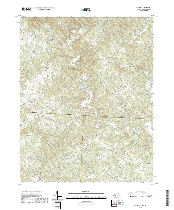
2022 Map of Claudville
USGS Topo · Published 2022About this map
The Ararat River and Dan River carve deep through the borderlands of Virginia and North Carolina, defining a landscape where family history and water resources are inextricably linked. This area of Patrick County and Stokes County is notably dense with ancestral sites, including the George Washington Clement Family Cem and the Unity Presbyterian Church Cem near the junction of Unity Church Rd. The terrain is characterized by intricate drainage patterns from tributaries like Hookers Cr and Little Dan River, which feed into the larger river systems. Genealogists will find a concentration of local landmarks such as Woodville Baptist Church Cem and the Albion Cem, situated among a network of secondary roads like Kibler Valley Rd and Ararat Hwy that follow the natural contours of the Piedmont foothills.
Find a feature on this map
122 named features on this map. Tap any name to fly to it.
Don’t see what you’re looking for? This feature index may not catch every label — zoom into the map to look around manually.
Map Details
Editions of this 2022 Claudville Map
This is the sole edition of this map. No revisions or reprints were ever made.
Other maps of this area

1889 · Hillsville
USGS Topo · 1:125,000

1891 · Yadkinville
USGS Topo · 1:125,000

1892 · Hillsville
USGS Topo · 1:125,000

1893 · Yadkinville
USGS Topo · 1:125,000

1896 · Hillsville
USGS Topo · 1:125,000

1928 · Stuart
USGS Topo · 1:48,000

1931 · Stuart
USGS Topo · 1:62,500

1953 · Winston-Salem
USGS Topo · 1:250,000

1955 · Winston-Salem
USGS Topo · 1:250,000

1957 · Mount Airy
USGS Topo · 1:62,500