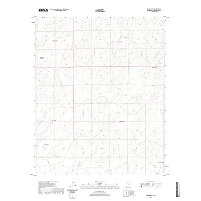
2020 Map of Claunch SE
USGS Topo · Published 2020About this map
Pinatosa Canyon and South Canyon define the drainage patterns of this high-desert landscape in Lincoln County. The map reveals a sparse network of ranching and access roads, including Tin Cup Rd and the Bar L Trl, which connect remote sections of the public land survey system. This 2020 edition documents the enduring rural infrastructure of the region, where Windmill Rd points to the essential water-pumping history of the area. The terrain is marked by significant topographical relief, particularly where Largo Canyon cuts through the southeastern corner. The transition between the T2S and T3S townships is clearly delineated, showing how contemporary county roads like Co Rd A020 and Co Rd A017 follow the natural contours and established property lines of the New Mexico interior.
Find a feature on this map
12 named features on this map. Tap any name to fly to it.
Don’t see what you’re looking for? This feature index may not catch every label — zoom into the map to look around manually.
Map Details
Editions of this 2020 Claunch SE Map
This is the sole edition of this map. No revisions or reprints were ever made.
Other maps of this area

1950 · Little Black Peak
USGS Topo · 1:62,500

1954 · Fort Sumner
USGS Topo · 1:250,000

1955 · Roswell
USGS Topo · 1:250,000

1958 · Fort Sumner
USGS Topo · 1:250,000

1958 · Roswell
USGS Topo · 1:250,000

1962 · Roswell
USGS Topo · 1:250,000

1973 · Ancho
USGS Topo · 1:24,000

1980 · Corona
USGS Topo · 1:100,000

1981 · Rough Mountain
USGS Topo · 1:24,000
1981 · Polecat Draw
USGS Topo · 1:24,000