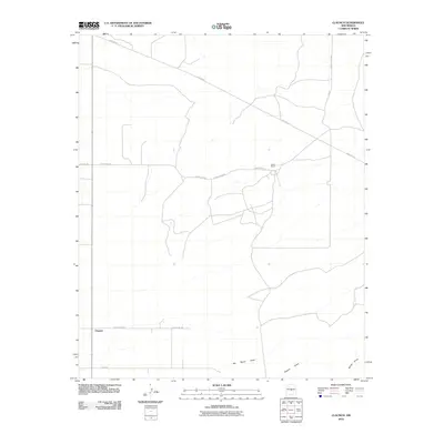
2010 Map of Claunch
USGS Topo · Published 2010About this map
Claunch serves as the primary focal point of this high-desert landscape in Socorro County, appearing here as it was surveyed in the early 21st century. The settlement's rural character is defined by a grid of local routes such as County Rd-208 and Wade Rd, while the broader region is crisscrossed by industrial infrastructure including the prominent Pipeline Rd. The terrain is marked by seasonal drainage patterns, most notably No Name Draw, Polecat Draw, and Secate Draw, which carve through the arid expanse towards the south and east. Dean Ranch stands as a significant landmark in the northern portion of the quadrangle, illustrating the enduring presence of ranching operations and family-named holdings in this part of New Mexico.
Find a feature on this map
12 named features on this map. Tap any name to fly to it.
Don’t see what you’re looking for? This feature index may not catch every label — zoom into the map to look around manually.
Map Details
Editions of this 2010 Claunch Map
This is the sole edition of this map. No revisions or reprints were ever made.
Other maps of this area

1954 · Fort Sumner
USGS Topo · 1:250,000

1954 · Socorro
USGS Topo · 1:250,000

1958 · Socorro
USGS Topo · 1:250,000

1958 · Fort Sumner
USGS Topo · 1:250,000

1962 · Socorro
USGS Topo · 1:250,000

1972 · Gran Quivira
USGS Topo · 1:24,000
1972 · Cat Mesa
USGS Topo · 1:24,000
1972 · Turkey Ridge NE
USGS Topo · 1:24,000
1979 · Socorro
USGS Topo · 1:100,000

1980 · Corona
USGS Topo · 1:100,000