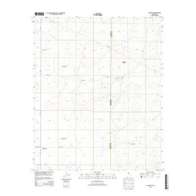
2013 Map of Claunch
USGS Topo · Published 2013About this map
Claunch anchors this high-plains landscape where the borders of Socorro and Lincoln counties meet in central New Mexico. The area is defined by a series of drainage features including No Name Draw, Polecat Draw, and Sacate Draw, which carve through the terrain beneath the profile of Rough Mtn. This 2013 survey illustrates a rural settlement pattern centered on ranching operations and water management, evidenced by the presence of Crabtree Tank and Victor Tank.
Find a feature on this map
23 named features on this map. Tap any name to fly to it.
Don’t see what you’re looking for? This feature index may not catch every label — zoom into the map to look around manually.
Map Details
Editions of this 2013 Claunch Map
This is the sole edition of this map. No revisions or reprints were ever made.
Other maps of this area

1954 · Fort Sumner
USGS Topo · 1:250,000

1954 · Socorro
USGS Topo · 1:250,000

1958 · Socorro
USGS Topo · 1:250,000

1958 · Fort Sumner
USGS Topo · 1:250,000

1962 · Socorro
USGS Topo · 1:250,000

1972 · Gran Quivira
USGS Topo · 1:24,000
1972 · Cat Mesa
USGS Topo · 1:24,000
1972 · Turkey Ridge NE
USGS Topo · 1:24,000
1979 · Socorro
USGS Topo · 1:100,000

1980 · Corona
USGS Topo · 1:100,000