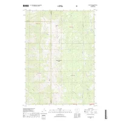
2017 Map of Clause Peak
USGS Topo · Published 2017About this map
Teton National Forest encompasses this high-elevation landscape where the boundaries of Teton, Lincoln, and Sublette counties converge. The terrain is defined by prominent summits such as Ramshorn Peak and Clause Peak, which overlook a complex network of drainage basins. To the southwest, the distinctive plateau of Horse Heaven stands near the headwaters of Hunter Creek.
Find a feature on this map
37 named features on this map. Tap any name to fly to it.
Don’t see what you’re looking for? This feature index may not catch every label — zoom into the map to look around manually.
Map Details
Editions of this 2017 Clause Peak Map
This is the sole edition of this map. No revisions or reprints were ever made.
Other maps of this area

1907 · Gros Ventre
USGS Topo · 1:125,000

1910 · Gros Ventre
USGS Topo · 1:125,000

1931 · Jackson
USGS Topo · 1:125,000

1935 · Jackson
USGS Topo · 1:125,000

1955 · Driggs
USGS Topo · 1:250,000

1958 · Driggs
USGS Topo · 1:250,000

1962 · Driggs
USGS Topo · 1:250,000

1965 · Pickle Pass
USGS Topo · 1:24,000

1965 · Camp Davis
USGS Topo · 1:24,000
1965 · Bailey Lake
USGS Topo · 1:24,000