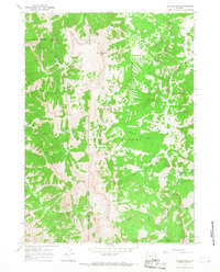
1965 Map of Clause Peak
USGS Topo · Published 1968About this map
Teton National Forest dominates this mid-1960s landscape, where three county lines—Teton, Lincoln, and Sublette—converge in a complex high-altitude drainage system. The terrain is defined by prominent summits like Clause Peak and Ramshorn Peak, which anchor a network of alpine waterways. A single Pack Trail provides the primary means of navigating the steep topography between the drainages of Cliff Creek and Clause Creek. The nomenclature of the area reveals a distinct local character, with water features such as Halfturn Creek and Fullturn Creek suggesting the winding nature of the mountain passes. Researchers will note the density of family-named water bodies like Sandy Marshall Creek and Gibbs Creek, alongside more descriptive landmarks like Burnt Creek and Snag Creek, reflecting the early livestock and trapping history of this Wyoming wilderness.
Find a feature on this map
24 named features on this map. Tap any name to fly to it.
Don’t see what you’re looking for? This feature index may not catch every label — zoom into the map to look around manually.
Map Details
Editions of this 1965 Clause Peak Map
This is the sole edition of this map. No revisions or reprints were ever made.
Other maps of this area

1907 · Gros Ventre
USGS Topo · 1:125,000

1910 · Gros Ventre
USGS Topo · 1:125,000

1931 · Jackson
USGS Topo · 1:125,000

1935 · Jackson
USGS Topo · 1:125,000

1955 · Driggs
USGS Topo · 1:250,000

1958 · Driggs
USGS Topo · 1:250,000

1962 · Driggs
USGS Topo · 1:250,000

1965 · Pickle Pass
USGS Topo · 1:24,000

1965 · Camp Davis
USGS Topo · 1:24,000
1965 · Bailey Lake
USGS Topo · 1:24,000