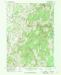
1960 Map of Claverack
USGS Topo · Published 1970About this map
Claverack and the surrounding Columbia County townships represent a well-developed mid-century agricultural and suburban landscape defined by its waterways and historic transit corridors. The topography is anchored by the Taconic State Parkway and the New York Central railroad, which serve as modern and legacy lifelines for the area. Water power, once vital to local industry, is evidenced by settlements like Linlithgo Mills and Glenco Mills, along with the prominent High Falls near Philmont.
Find a feature on this map
59 named features on this map. Tap any name to fly to it.
Don’t see what you’re looking for? This feature index may not catch every label — zoom into the map to look around manually.
Map Details
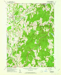
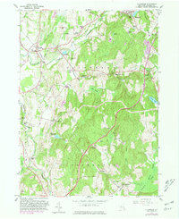
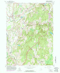
Editions of this 1960 Claverack Map
4 editions found
Other maps of this area

1893 · Coxsackie
USGS Topo · 1:62,500

1894 · Coxsackie
USGS Topo · 1:62,500

1895 · Catskill
USGS Topo · 1:62,500

1902 · Copake
USGS Topo · 1:62,500

1903 · Kinderhook
USGS Topo · 1:62,500

1904 · Copake
USGS Topo · 1:62,500

1929 · Coxsackie
USGS Topo · 1:62,500

1933 · Kinderhook
USGS Topo · 1:62,500

1934 · Catskill
USGS Topo · 1:62,500

1938 · Catskill
USGS Topo · 1:62,500