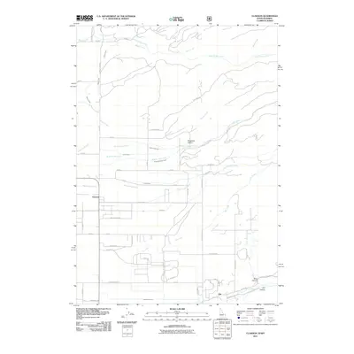
2011 Map of Clawson
USGS Topo · Published 2011About this map
Agricultural water management and high-altitude ranching dominate this landscape on the border of Idaho and Wyoming. Clawson sits at the center of an intricate network of irrigation systems, including the Haden Canal, North Leigh Canal, and the Edison and Ricks Canal. These waterways underscore the region's reliance on mountain runoff to support the farmsteads along Trouts Ranch Rd and Butler Ln. The terrain shifts dramatically as one moves toward the foothills, where Wiggleton Hollow and Teton Canyon provide a backdrop to the settlement of Alta. The grid of rural roads, such as N Stateline Rd, reveals the precise surveying of the borderlands while following the natural paths carved by South Leigh Creek and Dry Creek.
Find a feature on this map
68 named features on this map. Tap any name to fly to it.
Don’t see what you’re looking for? This feature index may not catch every label — zoom into the map to look around manually.
Map Details
Editions of this 2011 Clawson Map
This is the sole edition of this map. No revisions or reprints were ever made.
Other maps of this area

1899 · Grand Teton
USGS Topo · 1:125,000

1901 · Grand Teton
USGS Topo · 1:125,000

1943 · Driggs
USGS Topo · 1:62,500

1946 · Driggs
USGS Topo · 1:62,500

1955 · Driggs
USGS Topo · 1:250,000

1958 · Driggs
USGS Topo · 1:250,000

1962 · Driggs
USGS Topo · 1:250,000

1965 · Lamont
USGS Topo · 1:24,000

1965 · Mc Renolds Reservoir
USGS Topo · 1:24,000

1965 · Clawson
USGS Topo · 1:24,000