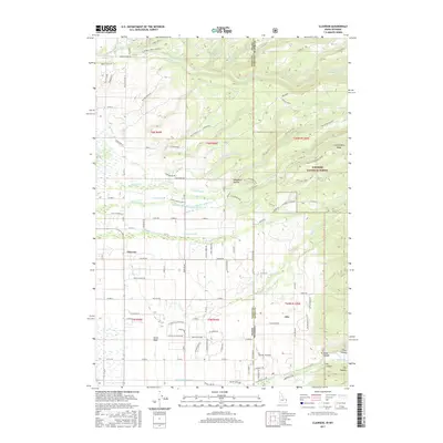
2017 Map of Clawson
USGS Topo · Published 2017About this map
The agricultural landscape of Teton Basin is defined by a complex network of irrigation infrastructure along the Idaho-Wyoming border. Managed water systems such as the Kilpack Canal, Haden Canal, and Hog Canal divert flow from mountain drainages to support the high-altitude farming near the community of Clawson. To the east, the terrain rises sharply into the Targhee National Forest, where steep canyons like Teton Canyon and Dry Canyon emerge from Commissary Ridge. The map documents the rural interface where developed ranching land meets the wilderness, including the settlement of Alta and the isolated Pratt Cem. This layout reflects the early 21st-century reliance on mountain snowmelt, channeled through historic routes like the Edison and Ricks Canal and N Leigh Canal to maintain the valley's productivity.
Find a feature on this map
123 named features on this map. Tap any name to fly to it.
Don’t see what you’re looking for? This feature index may not catch every label — zoom into the map to look around manually.
Map Details
Editions of this 2017 Clawson Map
This is the sole edition of this map. No revisions or reprints were ever made.
Other maps of this area

1899 · Grand Teton
USGS Topo · 1:125,000

1901 · Grand Teton
USGS Topo · 1:125,000

1943 · Driggs
USGS Topo · 1:62,500

1946 · Driggs
USGS Topo · 1:62,500

1955 · Driggs
USGS Topo · 1:250,000

1958 · Driggs
USGS Topo · 1:250,000

1962 · Driggs
USGS Topo · 1:250,000

1965 · Lamont
USGS Topo · 1:24,000

1965 · Mc Renolds Reservoir
USGS Topo · 1:24,000

1965 · Clawson
USGS Topo · 1:24,000