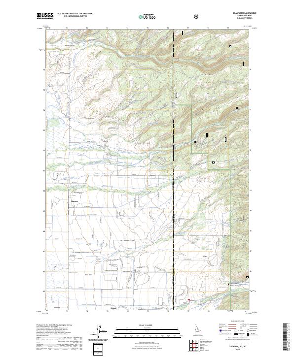
2024 Map of Clawson
USGS Topo · Published 2024About this map
The agricultural heart of Teton Basin is defined by a dense network of irrigation systems and family-owned ranch lands. Settlements like Clawson and the outskirts of Driggs are linked by an extensive series of waterways including the Haden Canal, Kilpack Canal, and the Edison and Ricks Canal, reflecting the region's long-standing reliance on high-altitude water management. To the east, the terrain rises sharply toward the Targhee National Forest, crossing the Idaho-Wyoming border where the community of Alta is situated. This landscape transitions from the flat valley floor to the prominent heights of Commissary Ridge and The Highlands. Genealogists and local historians can locate specific sites such as the Pratt Cem and the Badger Creek Ranch, while the numerous drainage features like Bustle Creek and Teton Creek trace the natural path of snowmelt through the canyons.
Find a feature on this map
100 named features on this map. Tap any name to fly to it.
Don’t see what you’re looking for? This feature index may not catch every label — zoom into the map to look around manually.
Map Details
Editions of this 2024 Clawson Map
This is the sole edition of this map. No revisions or reprints were ever made.
Other maps of this area

1899 · Grand Teton
USGS Topo · 1:125,000

1901 · Grand Teton
USGS Topo · 1:125,000

1943 · Driggs
USGS Topo · 1:62,500

1946 · Driggs
USGS Topo · 1:62,500

1955 · Driggs
USGS Topo · 1:250,000

1958 · Driggs
USGS Topo · 1:250,000

1962 · Driggs
USGS Topo · 1:250,000

1965 · Lamont
USGS Topo · 1:24,000

1965 · Mc Renolds Reservoir
USGS Topo · 1:24,000

1965 · Clawson
USGS Topo · 1:24,000