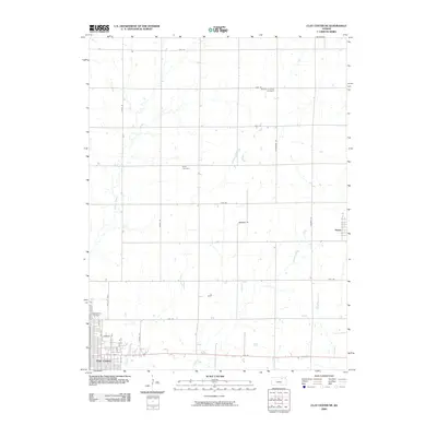
2009 Map of Clay Center NE
USGS Topo · Published 2009About this map
The northeastern portion of Clay Center serves as the primary urban anchor for this Kansas landscape, where the town's residential grid meets the expansive agricultural reaches of Clay County. The map provides significant genealogical value through its documentation of rural burial grounds, including the Brethren in Christ Cemetery in the north and Hayes Cemetery located near the center of the sheet. Further south, the expansive Greenwood Cemetery borders the edge of the city limits. The terrain is defined by a series of north-south and east-west rural roads that navigate the winding paths of several waterways. Lincoln Creek, Finney Creek, and Spring Creek cut through the prairie, creating a natural drainage pattern that contrasts with the rigid section-line road system. The small settlement of Green is visible on the eastern edge, connected to the wider region by 20th Rd and Thunder Rd.
Find a feature on this map
26 named features on this map. Tap any name to fly to it.
Don’t see what you’re looking for? This feature index may not catch every label — zoom into the map to look around manually.
Map Details
Editions of this 2009 Clay Center NE Map
This is the sole edition of this map. No revisions or reprints were ever made.
Other maps of this area

1886 · Junction City
USGS Topo · 1:125,000

1889 · Marysville
USGS Topo · 1:125,000

1889 · Junction City
USGS Topo · 1:125,000

1891 · Clay Center
USGS Topo · 1:125,000

1893 · Washington
USGS Topo · 1:125,000

1894 · Junction City
USGS Topo · 1:125,000

1894 · Marysville
USGS Topo · 1:125,000

1955 · Manhattan
USGS Topo · 1:250,000

1956 · Manhattan
USGS Topo · 1:250,000

1957 · Manhattan
USGS Topo · 1:250,000