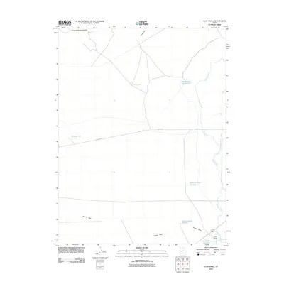
2010 Map of Clay Knoll
USGS Topo · Published 2010About this map
Clay Knoll anchors the southeastern corner of this high-desert landscape in Millard County, Utah, where ancient watercourses and modern infrastructure intersect. The drainage of Old River Bed winds north across the eastern portion of the sheet, a significant geological remnant accompanied by the Marshall Ditch and several man-made catchments like the West Marshall Tract Reservoir. These features, along with North Clay Knoll Reservoir and West Clay Knoll Reservoir, indicate the critical importance of water management in this arid environment.
Find a feature on this map
15 named features on this map. Tap any name to fly to it.
Don’t see what you’re looking for? This feature index may not catch every label — zoom into the map to look around manually.
Map Details
Editions of this 2010 Clay Knoll Map
This is the sole edition of this map. No revisions or reprints were ever made.
Other maps of this area

1885 · Sevier Desert
USGS Topo · 1:250,000

1908 · Fish Springs
USGS Topo · 1:250,000

1910 · Fish Springs
USGS Topo · 1:250,000

1953 · Delta
USGS Topo · 1:250,000

1958 · Delta
USGS Topo · 1:250,000

1962 · Delta
USGS Topo · 1:250,000

1971 · Smelter Knolls East
USGS Topo · 1:24,000

1971 · Clay Knoll
USGS Topo · 1:24,000

1971 · Rocky Knoll
USGS Topo · 1:24,000
1971 · Pot Mountain
USGS Topo · 1:24,000