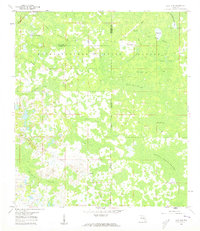
1960 Map of Clay Sink
USGS Topo · Published 1962About this map
The Withlacoochee State Forest dominates this Central Florida landscape, where the borders of Hernando, Pasco, and Sumter counties converge in a vast network of wetlands and pine flatwoods. In the early 1960s, small settlements such as Richloam, Bevels Place, and Sturkey provided human outposts within the wilderness, connected by the Atlantic Coast Line railroad and a grid of forestry tracks including North Grade and South Grade. The terrain is defined by its complex hydrology, featuring the Little Withlacoochee River and a series of named wetlands like Devils Creek Swamp, Wildcat Swamp, and Yankee Swamp. Notable landmarks such as the Landing Field (Abandoned) and various Cem locations offer specific points of interest for local historians. This era shows the region before major modern development, emphasizing a landscape of cypress ponds and sloughs like Gator Hole Slough.
Find a feature on this map
28 named features on this map. Tap any name to fly to it.
Don’t see what you’re looking for? This feature index may not catch every label — zoom into the map to look around manually.
Map Details
Editions of this 1960 Clay Sink Map
2 editions found
Other maps of this area

1955 · Plant City
USGS Topo · 1:250,000

1955 · Orlando
USGS Topo · 1:250,000

1957 · Orlando
USGS Topo · 1:250,000

1958 · Orlando
USGS Topo · 1:250,000

1958 · Plant City
USGS Topo · 1:250,000

1958 · Webster
USGS Topo · 1:24,000

1958 · Saint Catherine
USGS Topo · 1:24,000

1959 · Plant City
USGS Topo · 1:250,000

1960 · Lacoochee
USGS Topo · 1:24,000

1960 · Branchborough
USGS Topo · 1:24,000