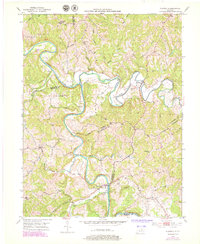
1952 Map of Claysville
USGS Topo · Published 1979About this map
The Licking River winds through a complex borderland of North Central Kentucky, where the boundaries of Bracken, Harrison, Robertson, and Pendleton counties meet in a series of sharp ridges and deep valleys. Centered on the settlement of Claysville, the landscape is defined by the confluence of several major waterways, including the North Fork Licking River and the West Licking River. The 1950s terrain is characterized by dispersed agricultural homesteads and several small rural centers like Milford and Sunrise.
Find a feature on this map
36 named features on this map. Tap any name to fly to it.
Don’t see what you’re looking for? This feature index may not catch every label — zoom into the map to look around manually.
Map Details
Editions of this 1952 Claysville Map
2 editions found
Other maps of this area

1929 · Cynthiana
USGS Topo · 1:48,000

1930 · Falmouth
USGS Topo · 1:48,000

1934 · Cynthiana
USGS Topo · 1:62,500

1936 · Falmouth
USGS Topo · 1:62,500

1952 · Mount Olivet
USGS Topo · 1:24,000

1952 · Piqua
USGS Topo · 1:24,000

1952 · Berlin
USGS Topo · 1:24,000

1952 · Shady Nook
USGS Topo · 1:24,000

1952 · Brooksville
USGS Topo · 1:24,000

1952 · Claysville
USGS Topo · 1:24,000