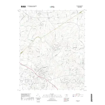
2019 Map of Clayton
USGS Topo · Published 2019About this map
The Neuse River bends across the Johnston and Wake County line, anchoring a landscape defined by traditional agrarian roots and modern suburban development. The town of Clayton serves as the central hub, with its established street grid and historical sites like Maplewood Cem and Horne Cem. To the north, Archer Lodge and Shotwell mark smaller settlement areas, while the surrounding countryside is punctuated by family-named landmarks and water features such as Yates Millpond and MacGregor Downs Lake.
Find a feature on this map
227 named features on this map. Tap any name to fly to it.
Don’t see what you’re looking for? This feature index may not catch every label — zoom into the map to look around manually.
Map Details
Editions of this 2019 Clayton Map
This is the sole edition of this map. No revisions or reprints were ever made.
Other maps of this area

1943 · Raleigh
USGS Topo · 1:62,500

1951 · Raleigh
USGS Topo · 1:62,500

1953 · Raleigh
USGS Topo · 1:250,000

1954 · Raleigh
USGS Topo · 1:250,000

1964 · Garner
USGS Topo · 1:24,000

1964 · Flowers
USGS Topo · 1:24,000

1964 · Selma
USGS Topo · 1:62,500

1964 · Clayton
USGS Topo · 1:24,000

1964 · Edmondson
USGS Topo · 1:24,000

1964 · Garner
USGS Topo · 1:62,500