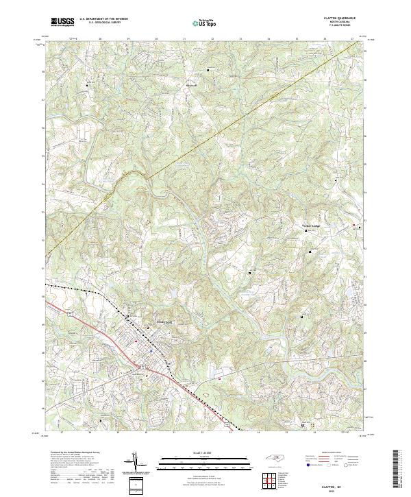
2022 Map of Clayton
USGS Topo · Published 2022About this map
The Clayton town center serves as the focal point of this Johnston County study, where the Norfolk Southern rail line cuts through the grid of established streets. The landscape is defined by the winding course of the Neuse River as it passes southeast of the Wake Co Johnston Co boundary line. Numerous small cemeteries are scattered across the terrain, including Maplewood Cem, Horne Cem, and McCullers Cem, providing valuable points of reference for genealogists tracing local families.
Find a feature on this map
240 named features on this map. Tap any name to fly to it.
Don’t see what you’re looking for? This feature index may not catch every label — zoom into the map to look around manually.
Map Details
Editions of this 2022 Clayton Map
This is the sole edition of this map. No revisions or reprints were ever made.
Other maps of this area

1943 · Raleigh
USGS Topo · 1:62,500

1951 · Raleigh
USGS Topo · 1:62,500

1953 · Raleigh
USGS Topo · 1:250,000

1954 · Raleigh
USGS Topo · 1:250,000

1964 · Garner
USGS Topo · 1:24,000

1964 · Flowers
USGS Topo · 1:24,000

1964 · Selma
USGS Topo · 1:62,500

1964 · Clayton
USGS Topo · 1:24,000

1964 · Edmondson
USGS Topo · 1:24,000

1964 · Garner
USGS Topo · 1:62,500