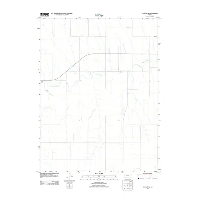
2012 Map of Clayton SW
USGS Topo · Published 2012About this map
N Fork Solomon River meanders across this rural section of Decatur County, shaping the drainage patterns and topography of the Kansas high plains. This 2012 survey documents a landscape dominated by agriculture and the section-line road network characteristic of the region, including Road B B and Road W-13. For those researching local family history, the Allison Cem is a significant genealogical anchor, positioned near the river's path. Small tributaries like Spring Cr feed the larger river system, reflecting the sparse but vital water resources that have guided settlement and land use in this part of Northwest Kansas for generations.
Find a feature on this map
5 named features on this map. Tap any name to fly to it.
Don’t see what you’re looking for? This feature index may not catch every label — zoom into the map to look around manually.
Map Details
Editions of this 2012 Clayton SW Map
This is the sole edition of this map. No revisions or reprints were ever made.
Other maps of this area

1954 · Goodland
USGS Topo · 1:250,000

1956 · Goodland
USGS Topo · 1:250,000

1957 · Goodland
USGS Topo · 1:250,000

1978 · Clayton SW
USGS Topo · 1:24,000

1978 · Clayton
USGS Topo · 1:24,000
1978 · Jennings
USGS Topo · 1:24,000

1978 · Allison
USGS Topo · 1:24,000

1978 · Lenora West
USGS Topo · 1:24,000
1978 · Clayton NE
USGS Topo · 1:24,000

1979 · Lucerne
USGS Topo · 1:24,000