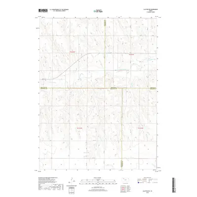
2018 Map of Clayton SW
USGS Topo · Published 2018About this map
N Fork Solomon River meanders across the northern half of this landscape, carving a valley through the high plains of Northwest Kansas. The river corridor defines the local geography, with Spring Cr feeding in from the south to join the larger drainage system. This area represents a point of geographic transition where the boundaries of four counties—Decatur, Norton, Sheridan, and Graham—converge in a complex intersection of rural jurisdictions. Settlement remains sparse, centered primarily on the early 21st-century agricultural grid. The Allison Cem stands as a solitary landmark of local heritage near the river, while a network of named section roads, including RD D D and RD W-15, provides the primary infrastructure for the farming community. The terrain is characterized by the dissected uplands of the Great Plains, where numerous unnamed draws and drainages break the flat horizon, leading down to the Solomon River valley.
Find a feature on this map
24 named features on this map. Tap any name to fly to it.
Don’t see what you’re looking for? This feature index may not catch every label — zoom into the map to look around manually.
Map Details
Editions of this 2018 Clayton SW Map
This is the sole edition of this map. No revisions or reprints were ever made.
Other maps of this area

1954 · Goodland
USGS Topo · 1:250,000

1956 · Goodland
USGS Topo · 1:250,000

1957 · Goodland
USGS Topo · 1:250,000

1978 · Clayton SW
USGS Topo · 1:24,000

1978 · Clayton
USGS Topo · 1:24,000
1978 · Jennings
USGS Topo · 1:24,000

1978 · Allison
USGS Topo · 1:24,000

1978 · Lenora West
USGS Topo · 1:24,000
1978 · Clayton NE
USGS Topo · 1:24,000

1979 · Lucerne
USGS Topo · 1:24,000