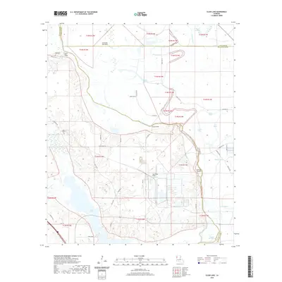
2020 Map of Clear Lake
USGS Topo · Published 2020About this map
Bayou Pierre and its intricate network of tributaries define this low-lying landscape where Caddo Parish, De Soto Parish, and Red River Parish converge. The topography is dominated by the Cannisnia Lake Basin, a broad alluvial plain interlaced with numerous waterways such as Prairie River, Watson Bayou, and Crook All Bayou. This 2020 survey illustrates the hydraulic complexity of the Red River valley, featuring the expansive Clear Lake One and landmarks like Hog Thief Point and Bill Gay Island. For local historians and genealogists, the map identifies specific burial sites, including the Old Gravel Point Cem near the Gravel Point Bridge and the New Friendship Cem further south. The distribution of rural routes like Friendship Rd and Red Lick Rd suggests a settled agricultural pattern amidst the wetlands.
Find a feature on this map
53 named features on this map. Tap any name to fly to it.
Don’t see what you’re looking for? This feature index may not catch every label — zoom into the map to look around manually.
Map Details
Editions of this 2020 Clear Lake Map
This is the sole edition of this map. No revisions or reprints were ever made.
Other maps of this area

1941 · East Point
USGS Topo · 1:31,680

1941 · Bossier Point
USGS Topo · 1:31,680

1945 · Mansfield
USGS Topo · 1:62,500

1947 · Ringgold
USGS Topo · 1:62,500

1947 · Mansfield
USGS Topo · 1:62,500

1948 · Coushatta
USGS Topo · 1:62,500

1948 · Caspiana
USGS Topo · 1:62,500

1955 · Shreveport
USGS Topo · 1:250,000

1955 · Caspiana
USGS Topo · 1:62,500

1956 · Shreveport
USGS Topo · 1:250,000