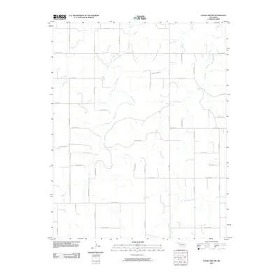
2010 Map of Clear Lake NW
USGS Topo · Published 2010About this map
Cottonwood Creek and Clear Creek wind through this rural Oklahoma landscape in the early 21st century, defining the drainage patterns of northwestern Beaver County. The terrain is structured by a strict rectilinear grid of local roads, such as Hollow E0180 and Hollow N1410, which delineate the expansive agricultural parcels characteristic of the High Plains. This network of thoroughfares, including Hollow E0200 and Hollow N1450, provides access to various dispersed homesteads and farms tucked into the prairie. Waterways like Camp Creek and Duck Pond Creek serve as critical natural landmarks within the systematic land divisions, reflecting the essential relationship between reliable water sources and the region's ranching and farming operations.
Find a feature on this map
34 named features on this map. Tap any name to fly to it.
Don’t see what you’re looking for? This feature index may not catch every label — zoom into the map to look around manually.
Map Details
Editions of this 2010 Clear Lake NW Map
This is the sole edition of this map. No revisions or reprints were ever made.
Other maps of this area

1954 · Perryton
USGS Topo · 1:250,000

1958 · Perryton
USGS Topo · 1:250,000

1970 · Mocane SE
USGS Topo · 1:24,000

1971 · Clear Lake NW
USGS Topo · 1:24,000

1971 · Clear Lake SW
USGS Topo · 1:24,000

1971 · Clear Lake
USGS Topo · 1:24,000

1971 · Clear Lake SE
USGS Topo · 1:24,000
1971 · Mocane SW
USGS Topo · 1:24,000

1973 · Balko NE
USGS Topo · 1:24,000

1973 · Elmwood
USGS Topo · 1:24,000