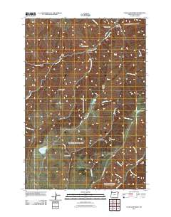
2011 Map of Clear Lake Ridge
USGS Topo · Published 2011About this map
Hells Canyon National Rec Area dominates the eastern boundary of this high-elevation landscape in Wallowa County. The terrain is defined by a series of prominent drainages and elevated landforms, including Clear Lake Ridge and Devils Ridge, which overlook a network of seasonal and perennial water systems. High-altitude water bodies such as Clear Lake, Downey Lake, and Dead Horse Lake are central features of the watershed, feeding into numerous gulches like Bear Gulch and Devils Gulch.
Find a feature on this map
35 named features on this map. Tap any name to fly to it.
Don’t see what you’re looking for? This feature index may not catch every label — zoom into the map to look around manually.
Map Details
Editions of this 2011 Clear Lake Ridge Map
This is the sole edition of this map. No revisions or reprints were ever made.
Other maps of this area

1954 · Imnaha
USGS Topo · 1:62,500

1954 · Harl Butte
USGS Topo · 1:62,500

1955 · Grangeville
USGS Topo · 1:250,000

1957 · Joseph
USGS Topo · 1:62,500

1957 · Elk Mountain
USGS Topo · 1:62,500

1959 · Grangeville
USGS Topo · 1:250,000

1980 · Grangeville
USGS Topo · 1:100,000

1982 · Wallowa
USGS Topo · 1:100,000

1986 · Enterprise
USGS Topo · 1:100,000

1987 · Riggins
USGS Topo · 1:100,000