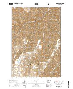
2020 Map of Clear Lake Ridge
USGS Topo · Published 2020About this map
Oregon Fish Hatchery sits in the northern reaches of this high-altitude landscape, where numerous gulches and ridges define the drainage patterns of the Wallowa National Forest. The topography is characterized by long, high spines like Clear Lake Ridge and Devils Ridge, which separate a complex network of seasonal and permanent watercourses. Notable water bodies including Clear Lake, Dead Horse Lake, and Downey Lake are scattered across these elevations, feeding into namesake creeks such as Dead Horse Cr and Rattlesnake Cr. The map reveals a land structured by its hydrology and timber resources, with names like Dixie Jett Gulch and Downey Gulch suggesting the local history of land use and early resource management in this corner of the state.
Find a feature on this map
34 named features on this map. Tap any name to fly to it.
Don’t see what you’re looking for? This feature index may not catch every label — zoom into the map to look around manually.
Map Details
Editions of this 2020 Clear Lake Ridge Map
This is the sole edition of this map. No revisions or reprints were ever made.
Other maps of this area

1954 · Imnaha
USGS Topo · 1:62,500

1954 · Harl Butte
USGS Topo · 1:62,500

1955 · Grangeville
USGS Topo · 1:250,000

1957 · Joseph
USGS Topo · 1:62,500

1957 · Elk Mountain
USGS Topo · 1:62,500

1959 · Grangeville
USGS Topo · 1:250,000

1980 · Grangeville
USGS Topo · 1:100,000

1982 · Wallowa
USGS Topo · 1:100,000

1986 · Enterprise
USGS Topo · 1:100,000

1987 · Riggins
USGS Topo · 1:100,000