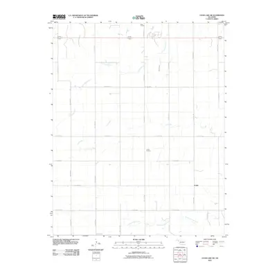
2010 Map of Clear Lake SW
USGS Topo · Published 2010About this map
Sophia occupies this section of Beaver County, characterized by a grid of rural roads and the meandering courses of prairie waterways. The settlement pattern is defined by isolated homesteads and local landmarks such as Sophia Cemetery and Barber Cemetery, providing essential focal points for genealogical research in this part of the Oklahoma Panhandle. The landscape is drained by a series of creeks flowing generally eastward, including Duck Pond Creek, Coon Creek, and the North Fork Kiowa Creek. The transportation network is strictly rectilinear, composed of numbered routes like Hollow N1440 and Hollow E0310, reflecting the organized land division of the High Plains. This 2010 survey captures the area before modern shifts in land use, documenting the enduring footprint of early 20th-century rural communities.
Find a feature on this map
22 named features on this map. Tap any name to fly to it.
Don’t see what you’re looking for? This feature index may not catch every label — zoom into the map to look around manually.
Map Details
Editions of this 2010 Clear Lake SW Map
This is the sole edition of this map. No revisions or reprints were ever made.
Other maps of this area

1954 · Perryton
USGS Topo · 1:250,000

1958 · Perryton
USGS Topo · 1:250,000

1971 · Clear Lake NW
USGS Topo · 1:24,000

1971 · Clear Lake SW
USGS Topo · 1:24,000

1971 · Clear Lake
USGS Topo · 1:24,000

1971 · Clear Lake SE
USGS Topo · 1:24,000

1972 · Darrouzett
USGS Topo · 1:24,000

1972 · Gaylord
USGS Topo · 1:24,000

1973 · Booker
USGS Topo · 1:24,000

1973 · Balko NE
USGS Topo · 1:24,000