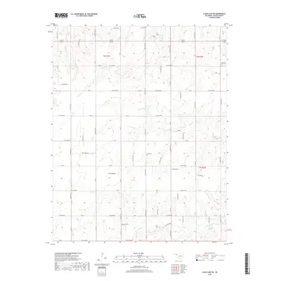
2018 Map of Clear Lake SW
USGS Topo · Published 2018About this map
Sophia Cem and other burial grounds sit at the heart of this Beaver County landscape, where the High Plains of the Oklahoma Panhandle are etched by seasonal drainages. The area is defined by a strictly surveyed grid of county roads, including Ew-30 and Ew-34, which cross the terrain at one-mile intervals. This geometry reflects the systematic land divisions of Township 1 North Range 24 East and surrounding blocks. Water courses like Duck Pond Cr and Coon Cr provide the primary natural breaks in the upland plains, while the N Fork Kiowa Cr cuts across the southern portion of the sheet. The prevalence of family or community-named sites, such as Barber Cem and Mountain View Cem, highlights the enduring footprint of rural settlement in a region where open space and agriculture dominate.
Find a feature on this map
19 named features on this map. Tap any name to fly to it.
Don’t see what you’re looking for? This feature index may not catch every label — zoom into the map to look around manually.
Map Details
Editions of this 2018 Clear Lake SW Map
This is the sole edition of this map. No revisions or reprints were ever made.
Other maps of this area

1954 · Perryton
USGS Topo · 1:250,000

1958 · Perryton
USGS Topo · 1:250,000

1971 · Clear Lake NW
USGS Topo · 1:24,000

1971 · Clear Lake SW
USGS Topo · 1:24,000

1971 · Clear Lake
USGS Topo · 1:24,000

1971 · Clear Lake SE
USGS Topo · 1:24,000

1972 · Darrouzett
USGS Topo · 1:24,000

1972 · Gaylord
USGS Topo · 1:24,000

1973 · Booker
USGS Topo · 1:24,000

1973 · Balko NE
USGS Topo · 1:24,000