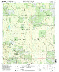
2000 Map of Clear Springs
USGS Topo · Published 2002About this map
Bienville National Forest dominates this landscape at the intersection of Scott, Newton, Smith, and Jasper Counties. The terrain is defined by a dense network of waterways, including the winding Tallahala Creek and West Tallahala Creek, which flow through heavily wooded sections and small clearings. Settlement is sparse, focused around the community of Clear Springs and the Marathon Recreation Area surrounding Marathon Lake.
Find a feature on this map
23 named features on this map. Tap any name to fly to it.
Don’t see what you’re looking for? This feature index may not catch every label — zoom into the map to look around manually.
Map Details
Editions of this 2000 Clear Springs Map
This is the sole edition of this map. No revisions or reprints were ever made.
Other maps of this area

1921 · Forest
USGS Topo · 1:48,000

1922 · Forest
USGS Topo · 1:62,500

1950 · Forest
USGS Topo · 1:62,500

1952 · Forest
USGS Topo · 1:62,500

1953 · Meridian
USGS Topo · 1:250,000

1957 · Meridian
USGS Topo · 1:250,000

1965 · Meridian
USGS Topo · 1:250,000

1966 · Newton
USGS Topo · 1:24,000

1968 · Clear Springs
USGS Topo · 1:24,000

1968 · Pineville
USGS Topo · 1:24,000