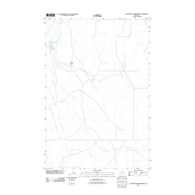
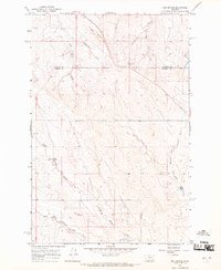
2011 Map of Clear Water Reservoir
USGS Topo · Published 2011About this map
Thompson Creek winds through this Rosebud County landscape, anchoring a water management system critical to the region's ranching and agricultural life. The map centers on the Clear Water Reservoir, regulated by the Pyba Reservoir Dam. These small-scale water features illustrate the engineering required to sustain activity in eastern Montana's semi-arid environment, further evidenced by the Montana Number 21 Dam situated along Pride Springs Creek.
Find a feature on this map
9 named features on this map. Tap any name to fly to it.
Don’t see what you’re looking for? This feature index may not catch every label — zoom into the map to look around manually.
Map Details
Editions of this 2011 Clear Water Reservoir Map
This is the sole edition of this map. No revisions or reprints were ever made.
Other maps of this area

1954 · Forsyth
USGS Topo · 1:250,000

1957 · Forsyth
USGS Topo · 1:250,000

1958 · Forsyth
USGS Topo · 1:250,000

1965 · Needle Butte
USGS Topo · 1:24,000

1965 · Clear Water Reservoir
USGS Topo · 1:24,000
1965 · Coleman Coulee
USGS Topo · 1:24,000
1965 · Christenson Reservoir
USGS Topo · 1:24,000
1965 · Hillside
USGS Topo · 1:24,000
1965 · Red Buttes
USGS Topo · 1:24,000

1969 · Van Burton Creek
USGS Topo · 1:24,000