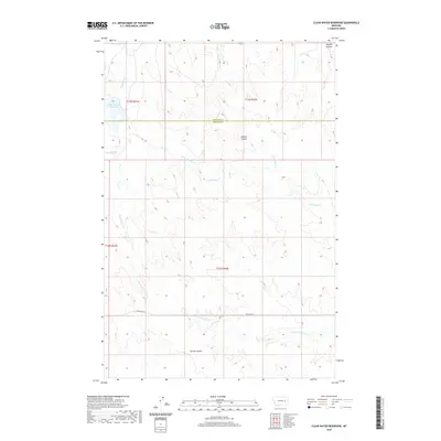
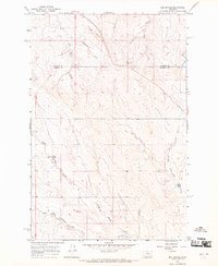
2020 Map of Clear Water Reservoir
USGS Topo · Published 2020About this map
The Garfield Co Rosebud Co boundary line bisects this high plains landscape, where water management is central to the local geography. The Clear Water Reservoir sits in the northwest, serving as a vital catchment in an area defined by its seasonal drainage patterns and coulees. The terrain is deeply inscribed by intermittent waterways like Thompson Cr, Bootjack Cr, and the various forks of N Sunday Cr, which illustrate the complex watershed of the Montana interior.
Find a feature on this map
16 named features on this map. Tap any name to fly to it.
Don’t see what you’re looking for? This feature index may not catch every label — zoom into the map to look around manually.
Map Details
Editions of this 2020 Clear Water Reservoir Map
This is the sole edition of this map. No revisions or reprints were ever made.
Other maps of this area

1954 · Forsyth
USGS Topo · 1:250,000

1957 · Forsyth
USGS Topo · 1:250,000

1958 · Forsyth
USGS Topo · 1:250,000

1965 · Needle Butte
USGS Topo · 1:24,000

1965 · Clear Water Reservoir
USGS Topo · 1:24,000
1965 · Coleman Coulee
USGS Topo · 1:24,000
1965 · Christenson Reservoir
USGS Topo · 1:24,000
1965 · Hillside
USGS Topo · 1:24,000
1965 · Red Buttes
USGS Topo · 1:24,000

1969 · Van Burton Creek
USGS Topo · 1:24,000