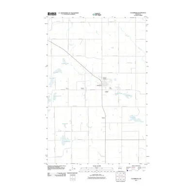
2010 Map of Clearbrook
USGS Topo · Published 2010About this map
Clearbrook serves as the central hub of this Clearwater County landscape, where the local road network converges near the Clearbrook Post Office and the Clearbrook City Park Campground. The surrounding terrain is defined by a glacial topography of numerous small basins, including Klongerbo Lake, Steenerson Lake, and Sterling Lake. Waterways like the Lost River and Silver Creek meander through the township sections, influencing the placement of early rural sites. Genealogists will find several notable burial grounds scattered across the quadrangle, such as Elim Cemetery to the west and Silver Creek Cemetery and Maple Hill Cemetery to the south and east. The rectilinear grid of county highways and township roads, including County Hwy-92 and County Hwy-74, provides a framework for the agricultural and residential properties of this northern Minnesota community.
Find a feature on this map
48 named features on this map. Tap any name to fly to it.
Don’t see what you’re looking for? This feature index may not catch every label — zoom into the map to look around manually.
Map Details
Editions of this 2010 Clearbrook Map
This is the sole edition of this map. No revisions or reprints were ever made.
Other maps of this area

1919 · Fosston
USGS Topo · 1:62,500

1919 · Churnes
USGS Topo · 1:62,500

1919 · Winsor
USGS Topo · 1:62,500

1943 · Bagley
USGS Topo · 1:62,500

1954 · Bemidji
USGS Topo · 1:250,000

1957 · Bemidji
USGS Topo · 1:250,000

1958 · Bemidji
USGS Topo · 1:250,000

1969 · Clearbrook
USGS Topo · 1:24,000

1969 · Leonard
USGS Topo · 1:24,000

1969 · Fosston SE
USGS Topo · 1:24,000