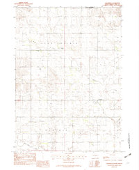
1982 Map of Clearfield
USGS Topo · Published 1982About this map
Clearfield stands at the center of this rural landscape, representing a quiet settlement in the southern reaches of Tripp County during the early 1980s. The geography is characterized by expansive prairie divisions such as Star Prairie, Wortman, and Dog Ear, which reflect the localized naming conventions and land divisions of the era. The presence of both the Star Prairie Ch and the Star Prairie Sch suggests a community infrastructure centered around rural crossroads and spiritual life, common in this part of South Dakota.
Find a feature on this map
12 named features on this map. Tap any name to fly to it.
Don’t see what you’re looking for? This feature index may not catch every label — zoom into the map to look around manually.
Map Details
Editions of this 1982 Clearfield Map
This is the sole edition of this map. No revisions or reprints were ever made.
Other maps of this area

1955 · Martin
USGS Topo · 1:250,000

1955 · Mitchell
USGS Topo · 1:250,000

1958 · Martin
USGS Topo · 1:250,000

1959 · Mitchell
USGS Topo · 1:250,000

1982 · Witten SE
USGS Topo · 1:25,000
1982 · Millboro
USGS Topo · 1:24,000

1982 · Keyapaha SE
USGS Topo · 1:24,000

1982 · Witten SW
USGS Topo · 1:25,000
1982 · Keyapaha NW
USGS Topo · 1:24,000
1982 · Dog Ear Buttes
USGS Topo · 1:25,000