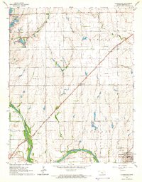
1965 Map of Clearwater
USGS Topo · Published 1966About this map
Ninnescah River meanders across this mid-century landscape, anchoring a region defined by agricultural heritage and the mid-continent oil boom. The town of Clearwater sits in the southeast corner, serving as a focal point near the Clearwater Oil Field and the Chambers Oil Field. The Atchison Topeka and Santa Fe railroad cuts a diagonal path through the township, connecting the small community of Clonmel to the broader Kansas rail network.
Find a feature on this map
25 named features on this map. Tap any name to fly to it.
Don’t see what you’re looking for? This feature index may not catch every label — zoom into the map to look around manually.
Map Details
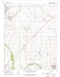
Editions of this 1965 Clearwater Map
2 editions found
Other maps of this area

1889 · Cheney
USGS Topo · 1:125,000

1889 · Wichita
USGS Topo · 1:125,000

1889 · Caldwell
USGS Topo · 1:125,000

1890 · Wellington
USGS Topo · 1:125,000

1891 · Cheney
USGS Topo · 1:125,000

1893 · Caldwell
USGS Topo · 1:125,000

1894 · Wichita
USGS Topo · 1:125,000

1897 · Caldwell
USGS Topo · 1:125,000

1901 · Cheney
USGS Topo · 1:125,000

1943 · Wichita West
USGS Topo · 1:31,680