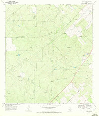
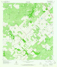
1969 Map of Clegg NE
USGS Topo · Published 1972About this map
The sparse landscape along the boundary of Mc Mullen Co Live Oak Co reveals a world of ranching and resource extraction in the late 1960s. This territory is defined by an extensive network of named water sources and pumping infrastructure necessary for cattle and industry, including uniquely named landmarks like the Piggly Wiggly Windmill, Jedionda Windmill, and Aqua Verde Windmill. The topography is etched by seasonal drainage such as Ramirena Creek and Leopard Branch, while family ranching operations like Lyne Ranch and Daugherty Ranch No 1 anchor the scattered settlement pattern. Industrial activity is prominent throughout the quadrangle, evidenced by numerous Oil Wells, a Gravel Pit, and the Iley Ranch Landing Strip, which provided air access to this isolated section of the Texas Brush Country.
Find a feature on this map
42 named features on this map. Tap any name to fly to it.
Don’t see what you’re looking for? This feature index may not catch every label — zoom into the map to look around manually.
Map Details
Editions of this 1969 Clegg NE Map
2 editions found
Other maps of this area

1920 · Mikeska
USGS Topo · 1:125,000

1927 · Oakville
USGS Topo · 1:62,500

1929 · Simmons
USGS Topo · 1:62,500

1953 · Crystal City
USGS Topo · 1:250,000

1955 · Crystal City
USGS Topo · 1:250,000

1961 · Crystal City
USGS Topo · 1:250,000
1963 · Anna Rose
USGS Topo · 1:24,000
1963 · Elm Creek
USGS Topo · 1:24,000
1963 · Oakville SW
USGS Topo · 1:24,000

1968 · Crystal City
USGS Topo · 1:250,000