1955 Map of Cleghorn Lakes
USGS Topo · Published 1967About this map
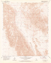
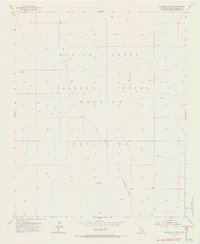
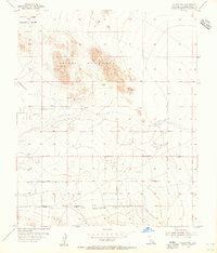
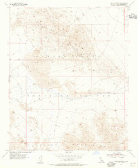
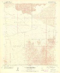
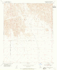
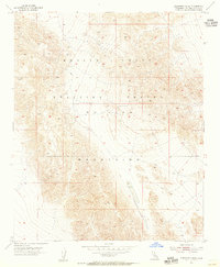
The Bullion Mountains dominate this 1955 survey of the San Bernardino high desert, where the elevation rises significantly at Bullion East VABM 4046 and Bald VABM 4079. This portion of the California desert is defined by its use as the Marine Corps Training Center, a designation that overlays much of the varied terrain. The ephemeral nature of the local water system is evident in the Cleghorn Lakes, which sit alongside a recorded Dry Well in the southern basin. Navigation across this arid landscape at mid-century was limited primarily to a Jeep Trail winding through the eastern sections, reflecting the era's reliance on specialized vehicles for crossing the sandy and rocky ground. This sheet provides a clear look at the topographic character of the region before further military expansion or modern desert infrastructure changed the surface of the land.
Find a feature on this map
10 named features on this map. Tap any name to fly to it.
Don’t see what you’re looking for? This feature index may not catch every label — zoom into the map to look around manually.
Map Details
Editions of this 1955 Cleghorn Lakes Map
3 editions found
Other maps of this area

1942 · Amboy
USGS Topo · 1:250,000

1943 · Amboy
USGS Topo · 1:250,000

1954 · Needles
USGS Topo · 1:250,000
1954 · Bristol Lake NW
USGS Topo · 1:24,000
1954 · Bristol Lake SW
USGS Topo · 1:24,000
1954 · Valley Mtn
USGS Topo · 1:24,000
1955 · Lead Mountain
USGS Topo · 1:24,000
1955 · Lead Mtn. NE
USGS Topo · 1:24,000
1955 · Lead Mountain SW
USGS Topo · 1:24,000
1955 · Cleghorn Lakes
USGS Topo · 1:24,000