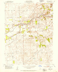
1952 Map of Clements
USGS Topo · Published 1954About this map
The Mokelumne River corridor defines this Central Valley landscape, where the heavy hand of resource extraction is visible in the extensive Dredge Tailings flanking its banks. Surveyed just after the war, the region around Clements shows a transition between industrial river operations and an established agricultural grid. The Southern Pacific railroad line runs parallel to the river, connecting the primary settlement of Clements to the outlying area near Brandt. Local history is centered on landmarks such as the Clements Glen View Cemetery and the curiously named Dogtown near the river bluffs. This survey reveals the complex water management systems of the era, including an Aqueduct and several small reservoirs that supported the shifting economy of San Joaquin and Amador counties.
Find a feature on this map
32 named features on this map. Tap any name to fly to it.
Don’t see what you’re looking for? This feature index may not catch every label — zoom into the map to look around manually.
Map Details
Editions of this 1952 Clements Map
2 editions found
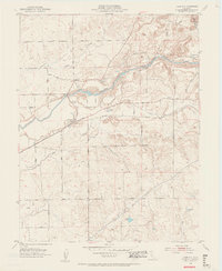
Other maps of this area

1889 · Jackson
USGS Topo · 1:125,000

1892 · Jackson
USGS Topo · 1:125,000

1894 · Lodi
USGS Topo · 1:125,000

1897 · Jackson
USGS Topo · 1:125,000

1902 · Jackson
USGS Topo · 1:125,000

1908 · Waterloo
USGS Topo · 1:31,680

1908 · Linden
USGS Topo · 1:31,680

1908 · Lockeford
USGS Topo · 1:31,680

1909 · Clay
USGS Topo · 1:31,680

1909 · Goose Creek
USGS Topo · 1:31,680