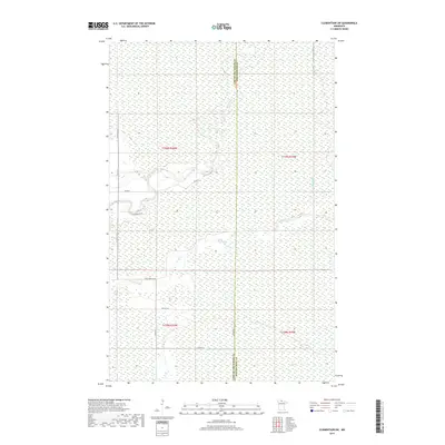
2019 Map of Clementson SW
USGS Topo · Published 2019About this map
The Rapid River and its tributary Bartons Brook define the hydrologic character of this borderland region where the north-south boundary line separates Lake of the Woods Co from Koochiching Co. The landscape is dominated by extensive wetland signatures and the winding course of the E Fork Rapid River, which meanders through the northeastern sections. Human imprint is primarily visible through a grid of rural roads and section lines, including Tamarack Dr SE and Hay Creek Rd SE, which provide access to this low-lying territory. The map illustrates the persistence of the Public Land Survey System in organizing the Northwoods, showing the intersections of Township 159 North and Township 158 North across Ranges 29 and 30 West.
Find a feature on this map
19 named features on this map. Tap any name to fly to it.
Don’t see what you’re looking for? This feature index may not catch every label — zoom into the map to look around manually.
Map Details
Editions of this 2019 Clementson SW Map
This is the sole edition of this map. No revisions or reprints were ever made.
Other maps of this area

1919 · Knutson
USGS Topo · 1:62,500

1921 · Baudette
USGS Topo · 1:62,500

1954 · Roseau
USGS Topo · 1:250,000

1957 · Roseau
USGS Topo · 1:250,000

1958 · Roseau
USGS Topo · 1:250,000

1968 · Baudette SE
USGS Topo · 1:24,000

1968 · Clementson
USGS Topo · 1:24,000

1968 · Border
USGS Topo · 1:24,000

1968 · Clementson SW
USGS Topo · 1:24,000

1968 · Clementson SE
USGS Topo · 1:24,000