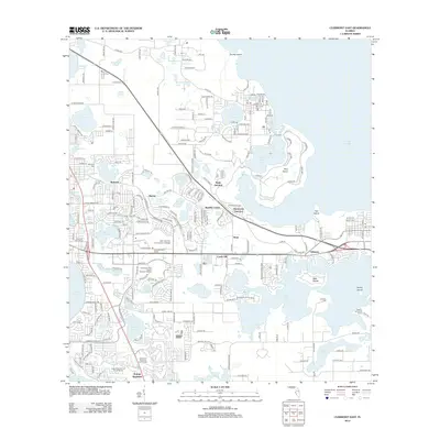
2012 Map of Clermont East
USGS Topo · Published 2012About this map
Lake Apopka defines the eastern boundary of this central Florida landscape, where a dense network of smaller basins like Johns Lake and Lake Minnehaha creates a fragmented terrain of islands and groves. This early 21st-century survey reveals the transitional character of the region, from the residential development near Killarney and Mohawk to the recreational hubs like the Cape Coral Executive Golf Course. Named islands such as Smiths Island, Pine Island, and Deer Island appear as high points within the wetlands. Local history is anchored by the Minneola Cem, Montverde Cem, and Williams Cem, while modern infrastructure is represented by the Lake- Sumter Community College and the prominent Clermont Water Tower. The settlement pattern reflects the area's growth around established junctions like Waits Junction and Montverde Junction.
Find a feature on this map
224 named features on this map. Tap any name to fly to it.
Don’t see what you’re looking for? This feature index may not catch every label — zoom into the map to look around manually.
Map Details
Editions of this 2012 Clermont East Map
This is the sole edition of this map. No revisions or reprints were ever made.
Other maps of this area

1953 · Windermere
USGS Topo · 1:24,000

1955 · Orlando
USGS Topo · 1:250,000

1956 · Winter Garden
USGS Topo · 1:24,000

1957 · Orlando
USGS Topo · 1:250,000

1958 · Orlando
USGS Topo · 1:250,000

1959 · Lake Nellie
USGS Topo · 1:24,000

1959 · Lake Louisa
USGS Topo · 1:24,000

1960 · Apopka
USGS Topo · 1:24,000

1962 · Orlando
USGS Topo · 1:250,000

1962 · Clermont East
USGS Topo · 1:24,000