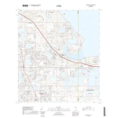
2018 Map of Clermont East
USGS Topo · Published 2018About this map
Lake Apopka and its western shoreline anchor this landscape on the edge of the Lake County and Orange County line. The map reveals a dense network of water bodies characterizing the Central Florida ridge, including the southern reaches of Lake Minnehaha and the varied basins of Johns Lake and Lake Felter. The elevation changes of the Wales Ridge and Orange Mountain define the topography, creating a distinct environment where settlements like Minneola, Montverde, and Clermont have grown between the lake shores.
Find a feature on this map
61 named features on this map. Tap any name to fly to it.
Don’t see what you’re looking for? This feature index may not catch every label — zoom into the map to look around manually.
Map Details
Editions of this 2018 Clermont East Map
This is the sole edition of this map. No revisions or reprints were ever made.
Other maps of this area

1953 · Windermere
USGS Topo · 1:24,000

1955 · Orlando
USGS Topo · 1:250,000

1956 · Winter Garden
USGS Topo · 1:24,000

1957 · Orlando
USGS Topo · 1:250,000

1958 · Orlando
USGS Topo · 1:250,000

1959 · Lake Nellie
USGS Topo · 1:24,000

1959 · Lake Louisa
USGS Topo · 1:24,000

1960 · Apopka
USGS Topo · 1:24,000

1962 · Orlando
USGS Topo · 1:250,000

1962 · Clermont East
USGS Topo · 1:24,000