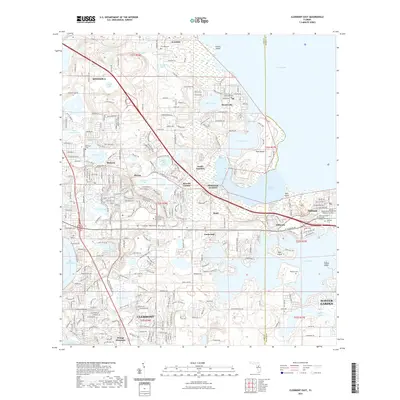
2021 Map of Clermont East
USGS Topo · Published 2021About this map
Lake Apopka and the surrounding central Florida ridge country define this landscape, where the town of Clermont and the growing municipality of Minneola meet a dense network of smaller historic settlements. The map documents the transition from the high ground of the Lake Wales Ridge down to the massive marshy bowl of the lake. Landmarks of educational and local history are prominent, including the University of Central Florida South Lake campus and numerous established burial grounds such as the Oakland African American Cem and Ferndale Cem. The transport corridors of W Colonial Dr and the converted rail path of the West Orange Trl connect the residential developments of Winter Garden and Oakland to the rural pockets at Reavills Corner and Waits Junction. Dozens of smaller water bodies, from Big Breedlove Lake to Lake Minnehaha, pattern the terrain between the ridges and the shoreline.
Find a feature on this map
70 named features on this map. Tap any name to fly to it.
Don’t see what you’re looking for? This feature index may not catch every label — zoom into the map to look around manually.
Map Details
Editions of this 2021 Clermont East Map
This is the sole edition of this map. No revisions or reprints were ever made.
Other maps of this area

1953 · Windermere
USGS Topo · 1:24,000

1955 · Orlando
USGS Topo · 1:250,000

1956 · Winter Garden
USGS Topo · 1:24,000

1957 · Orlando
USGS Topo · 1:250,000

1958 · Orlando
USGS Topo · 1:250,000

1959 · Lake Nellie
USGS Topo · 1:24,000

1959 · Lake Louisa
USGS Topo · 1:24,000

1960 · Apopka
USGS Topo · 1:24,000

1962 · Orlando
USGS Topo · 1:250,000

1962 · Clermont East
USGS Topo · 1:24,000