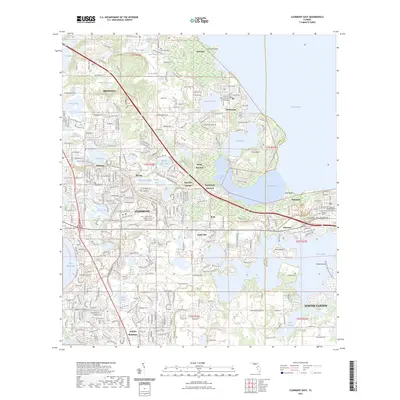
2023 Map of Clermont East
USGS Topo · Published 2023About this map
Clermont and its neighboring citrus-country settlements sit at a high-elevation nexus of Central Florida's lake region, where the terrain rises toward Orange Mountain. This modern survey details a landscape defined by water, from the massive reach of Lake Apopka in the northeast to the intricately connected basins of Johns Lake and Lake Minnehaha. The map traces the residential expansion and preservation efforts through the 2020s, including the sprawling Lake Louisa State Park and the academic footprint of Lake - Sumter State College South Lake Campus. Local history is preserved in sites like the Presbyterian Church Memorial Garden and several cemeteries including Oakland Cem and Williams Cem. The transition from old citrus groves to suburban corridors is evident along W Colonial Dr and Hartwood Marsh Rd, while older community nodes like Mohawk, Killarney, and Montverde maintain their distinct geographic identities.
Find a feature on this map
64 named features on this map. Tap any name to fly to it.
Don’t see what you’re looking for? This feature index may not catch every label — zoom into the map to look around manually.
Map Details
Editions of this 2023 Clermont East Map
This is the sole edition of this map. No revisions or reprints were ever made.
Other maps of this area

1953 · Windermere
USGS Topo · 1:24,000

1955 · Orlando
USGS Topo · 1:250,000

1956 · Winter Garden
USGS Topo · 1:24,000

1957 · Orlando
USGS Topo · 1:250,000

1958 · Orlando
USGS Topo · 1:250,000

1959 · Lake Nellie
USGS Topo · 1:24,000

1959 · Lake Louisa
USGS Topo · 1:24,000

1960 · Apopka
USGS Topo · 1:24,000

1962 · Orlando
USGS Topo · 1:250,000

1962 · Clermont East
USGS Topo · 1:24,000